Subject: Korea
Period: 1872 (circa)
Publication:
Color: Printed Color
Size:
12.4 x 19.2 inches
31.5 x 48.8 cm
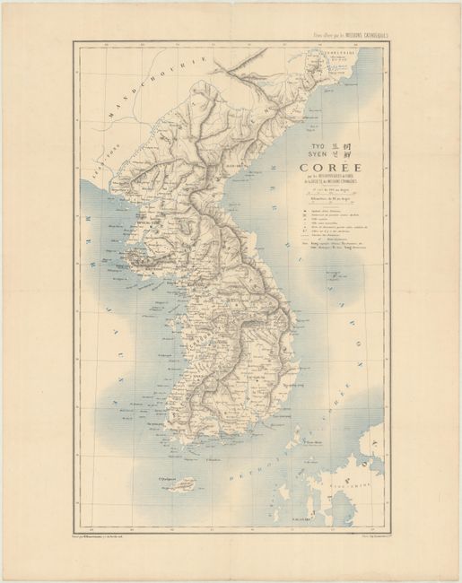
This highly detailed map of Korea was created by missionary R.P. Carceri on behalf of the Société des Missions Etrangères (Society of Foreign Missions). The map locates cities, villages, forts, foreign posts and "christian cities." The mountainous topography is graphically depicted. This map serves as an important record of the increasing presence of both foreigners and Christianity in Korea. Engraved by R. Hausermann and printed by Lemercier. The map was published by The Society of Foreign Missions of Paris, a Roman Catholic missionary institute founded in 1658. Its purpose was to evangelize foreign lands (primarily in Asia and North America) with the goal of adapting the church to local customs and establishing a native clergy. The group is still active today primarily in Asia.
References:
Condition: B+
issued folding, now flattened and fully backed in archival tissue to repair several short separations and tiny holes along the folds. There is a bit of offsetting and faint foxing.