Subject: China & Korea
Period: 1621 (published)
Publication: Atlas Minor
Color: Hand Color
Size:
7.5 x 5.8 inches
19.1 x 14.7 cm
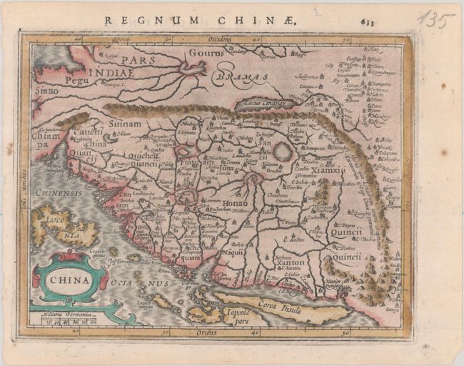
A charming map reduced from Jodocus Hondius' important map of the kingdom of China. Oriented with north to the right, it shows the eastern part of China (bounded in the west by the Great Wall) dominated by several large lakes and major rivers. Korea is a strangely shaped island, and the three main islands of Japan and the north part of the Philippines are included. This is the third state, with Siano changed to Sinao at top left. Latin text on verso. Third state, with minor changes to some place names.
References: Caboara #12.3; Van der Krogt (Vol. III) #8410:351.
Condition: A
The impression is a bit weak along the border. On a bright sheet with a few spots in the blank margins.