Subject: Northern Asia
Period: 1700 (dated)
Publication: Atlas Novus
Color: Hand Color
Size:
14 x 9.4 inches
35.6 x 23.9 cm
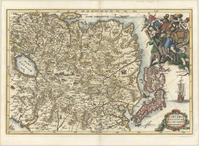
This interesting map covers Tartary, a great tract of northern and central Asia stretching from the Caspian Sea and the Ural Mountains to the Pacific Ocean. This map also extends to include northern Persia, India, China, and Japan. The depiction of Japan is very unusual with a large, distorted northern island of Hokkaido (Iedso) connected to Honshu by a narrow isthmus. The map is finely engraved with mountains, forests and cities with vignettes of animals and encampments. In the top right corner is a vivid illustration of a marauding horde of Tartar warriors attacking a Chinese wagon.
References: Shirley (BL Atlases) T.SHER-1a #103.
Condition: A
A sharp impression on a bright sheet with a hint of toning along the centerfold.