Subject: Caucasus & Middle East
Period: 1621 (circa)
Publication: Geografia cioe Descrittione Universale della Terra
Color: Black & White
Size:
6.8 x 4.9 inches
17.3 x 12.4 cm
Claudius Ptolemy was a mathematician, astronomer and geographer who worked in Alexandria, then a part of the Roman Empire, in the 2nd century AD. One of the most learned and influential men of his time, his theories dominated both astronomy and geography for nearly 1500 years. His writings were kept alive by Arabic scholars during the Middle Ages and reemerged in Europe during the Renaissance. The birth of printing led to wide dissemination of his great works on astronomy and geography. There were a number of editions of his Geographia beginning in 1477. These early editions contained maps based on his original writings, known as Ptolemaic maps. As geographic knowledge increased with the explorations of Columbus, Magellan, Cabot and others, maps of the New World were added, and maps of the Old World were revised. Ptolemy's Geographia continued to be revised and published by some of the most important cartographers including Martin Waldseemuller, Sebastian Munster, Giacomo Gastaldi, Jodocus Hondius, and Gerard Mercator (whose last edition was published in 1730).
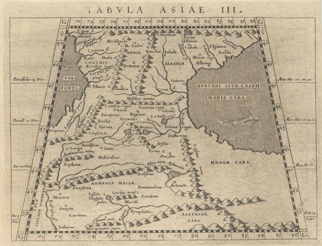
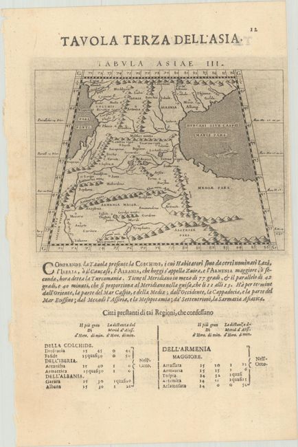
This sheet features two fine Ptolemaic maps showing the Caucasus and Middle East. The map on recto covers the region between the Black and Caspian Seas. The map is divided into four regions: Colchis, Iberia, Albania, and Armenia Maior. A large gate (Portae Albaniae) is shown in the mountains at the top of the map. This reflects the legend of Alexander the Great, who is said to have discovered the evil hordes of Gog and Magog in this region. Alexander, calling upon the power of God, moved the mountains together and built a mighty wall spanning the entire Caucasus range, closing off the civilized south from the forces of darkness. A sea monster swims through the Caspian Sea.
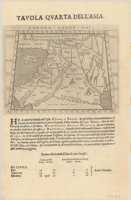
The map on verso spans from the region from the Mediterranean Sea and the island of Cyprus east to present-day Iraq and the Tigris and Euphrates Rivers, and from southern Turkey and Armenia Maior south to Arabiae Felicis Pars. Bedouin encampments are shown in the interior of Arabia Deserta. The map covers the entire Holy Land with many ancient coastal place names including Ptolemais, Sidon, and Tripolis. On a sheet of Italian text measuring 7.8 x 11.9".
References: Mickwitz & Miekkavaara #233-19 & 20.
Condition: A
A dark impression with light printer's ink residue. There is a printer's crease in the text.