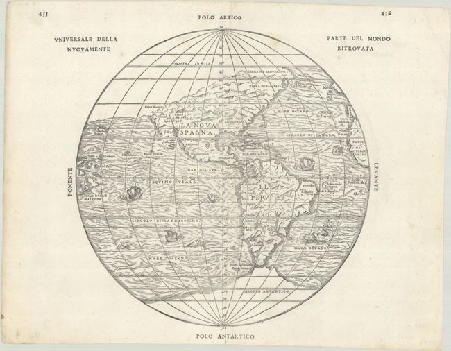
Subject: Western Hemisphere - America
Period: 1565 (published)
Publication: Navigationi et Viaggi, Vol. III
Color: Black & White
Size:
10.5 x 10.6 inches
26.7 x 26.9 cm
This extremely important map of the Americas includes the first mention of several names from the explorations of Coronado of 1540-42, including the elusive cities of Cibola and Quivira. The Sierra Nevadas appear for the first time, following the voyage of Juan Rodriguez Cabrillo in 1542. The map was originated by Gastaldi and is one of five he did for Ramusio. It leaves open the question of a land bridge from North America to Asia. This is the first issue from the second block, published in 1565. The first block, with identical geography, was destroyed in a fire at the printing establishment of Thomaso Guinti shortly after its publication in 1556. A nice example of this important and scarce map.
References: Burden #34; Mickwitz & Miekkavaara #641-9; Sabin #67741; Shirley (BL Atlases) G.RAMU-2a #10; Wagner (NW) #35; Wheat (TMW) #9.
Condition: A
A bright sheet with marginal soiling, minor professional repairs in the bottom corners of the sheet, and a remnant of hinge tape on verso.