Subject: Holy Land
Period: 1648 (dated)
Publication:
Color: Hand Color
Size:
19.2 x 12 inches
48.8 x 30.5 cm
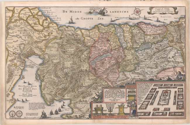
Lavishly decorated map of the Holy Land depicting the flight from Egypt. The Holy Land is divided among the tribes. The Kishon River connect the Mediterranean to the Sea of Galilee. There are numerous embellishments, including depictions of the encampment of the Children of Israel, temple vessels, Aaron & Moses, both sides of a shekel coin, a striking scene of Jonas and the whale, and several of Solomon's ships. Visscher's emblem, an old fisherman, is at right. Published in a Dutch Bible, with text on verso. This is the third state of this map, with the first state dated 1642.
References: Laor #785; Poortman & Augusteijn #85.
Condition: B+
A nice impression on a sheet that has been remargined at left and right to accommodate framing, with a section of neatline in facsimile at bottom right. A few short fold separations have been professionally repaired, and there is light soiling that is almost entirely confined to the margins.