Catalog Archive
Auction 206, Lot 557
Hondius' Elegant Map of Cyprus and Greek Islands
"Cyprus Ins: [on sheet with] Stalimini I. [and] Chius Insul. [and] Mitilene Ins. [and] Negroponte In. [and] Cerigo Insul. [and] Rhodus Ins.", Hondius, Jodocus
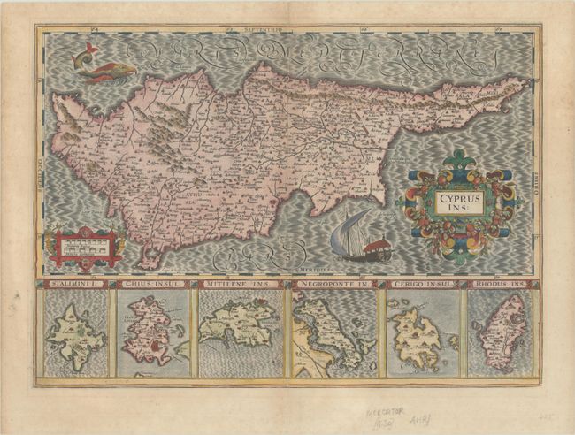
Subject: Cyprus
Period: 1623 (published)
Publication: Gerardi Mercatoris - Atlas sive Cosmographicae
Color: Hand Color
Size:
19.4 x 13.9 inches
49.3 x 35.3 cm
Download High Resolution Image
(or just click on image to launch the Zoom viewer)
(or just click on image to launch the Zoom viewer)