Subject: Sicily, Italy
Period: 1803 (published)
Publication: The Chronology and History of the World
Color: Black & White
Size:
22 x 16.6 inches
55.9 x 42.2 cm
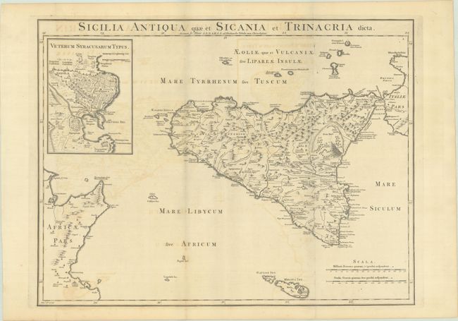
This handsome and detailed map of ancient Sicily extends to include numerous surrounding islands and the tip of Italy and Tunisia. The map depicts towns, roads, rivers, mountains, and an erupting Mt. Etna. At top left is a large inset with a bird's-eye plan of Syracuse. Engraved by Thomas Kitchin.
Blair's Chronology went through many editions well into the 19th century with maps added in the 1768 and later editions to help illustrate lands covered by the work, both ancient and modern. Through the years, most maps show little or no revision between the various editions.
References: cf. Shirley (BL Atlases) G.BLAI-1a #5.
Condition: B+
Issued folding on a sheet with "J Ruse" and Strasbourg Lily watermarks. There is some light offsetting and a short fold separation in the bottom margin that has been closed on verso with archival tape.