Catalog Archive
Auction 206, Lot 552

"Pianta Topografica della Citta di Roma dell' Anno 1829"

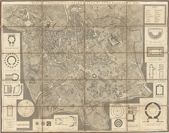
Subject: Rome, Italy

Period: 1829 (dated)

Publication:

Color: Black & White

Size:
31.6 x 24.4 inches
80.3 x 62 cm
Download High Resolution Image
(or just click on image to launch the Zoom viewer)

This superb, large map is a highly detailed bird's-eye plan of Rome. Roads and major sites are named, and the 14 administrative divisions of Rome, known as "Rioni," are numbered and named at top right. Surrounding the plan are 16 insets depicting floor plans of important buildings. Dissected in 20 panels and backed with linen. Engraved by Pietro Ruga and sold by Niecola de Antoni.

References:

Condition: B+

A crisp impression with light soiling and a number of short separations of the linen between the panels.

Estimate: $600 - $750

Sold for: $400

Closed on 11/12/2025

Archived