Catalog Archive
Auction 206, Lot 528

NO RESERVE

"La Russia Europea Divisa ne' suoi Governi e Provincie, Tratta dall' Atlante Russo", Zatta, Antonio

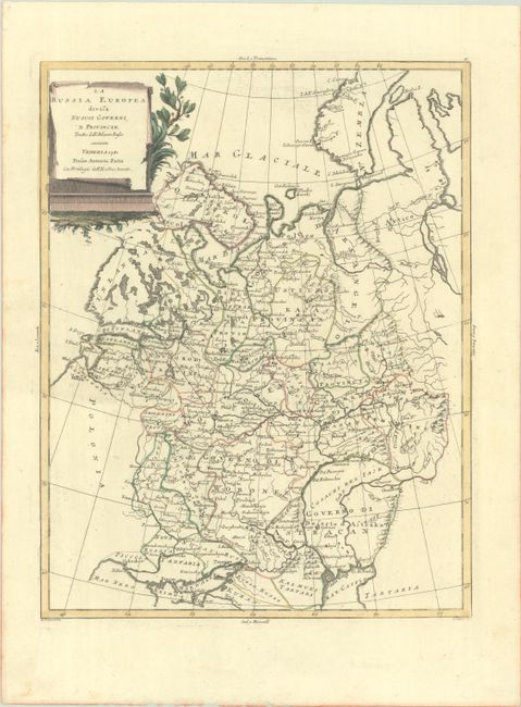
Subject: Russia in Europe

Period: 1781 (dated)

Publication: Atlante Novissimo

Color: Hand Color

Size:
12.5 x 16.1 inches
31.8 x 40.9 cm
Download High Resolution Image
(or just click on image to launch the Zoom viewer)

This detailed map illustrates the western portion of the Russian Empire, extending between the Baltic Sea, to the Black Sea, to the Barents Sea. Political boundaries, towns, rivers and mountains are well depicted, and a dotted line connects Moscow with St. Petersburg.

Antonio Zatta was one of the leading Italian cartographers and publishers of the time, and his Atlante Novissimo was one of the most beautifully produced 18th century atlases. He drew on the work of contemporary cartographers including Robert de Vaugondy and Bellin, and developed his own distinctive elegant style.

References: Shirley (BL Atlases) T.ZAT-1a Vol. 2 #30.

Condition: A

A crisp impression with full contemporary color. Near fine, with a hint of offsetting.

Estimate: $80 - $100

Sold for: $60

Closed on 11/12/2025

Archived