Subject: Eastern Europe, Poland
Period: 1720 (circa)
Publication:
Color: Hand Color
Size:
22.2 x 19.3 inches
56.4 x 49 cm
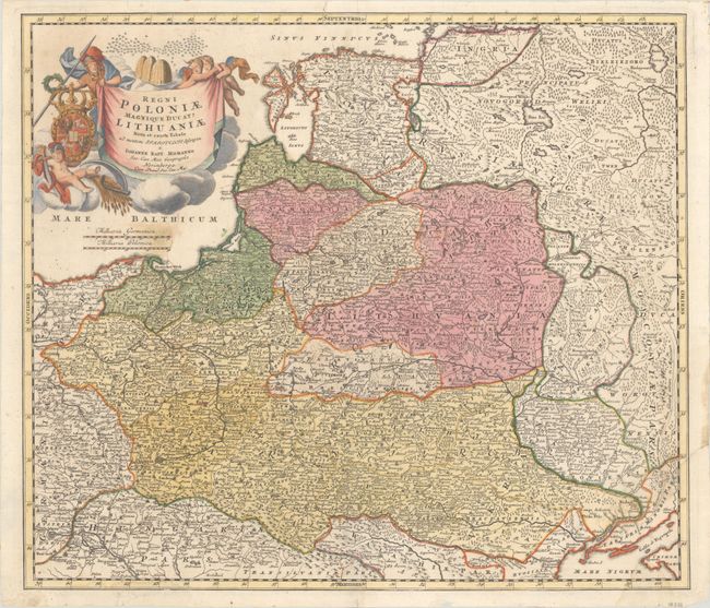
Homann's striking map covers Poland, Lithuania, Latvia, Estonia, and a portion of Russia, extending from St. Petersburg in the north to the Black Sea in the south. The map includes a lot of topographic detail and as well as the cities of Kiev, Minsk, Warsaw, and Vienna. A gorgeous allegorical cartouche fills the Baltic Sea and features Ares, god of war, holding both a spear and a laurel wreath; the Polish-Lithuanian coat of arms under Wettin dynasty; and beehives symbolizing industry.
References:
Condition: B+
A nice impression with edge tears measuring 2.5" at top and right which have been closed with archival tape on verso. There are light dampstains below the title and along the very bottom edge of map image. Old tape residue on verso does not appear on recto.