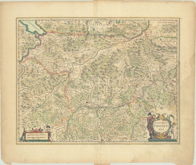
Subject: Western Austria & Northern Italy
Period: 1666 (circa)
Publication:
Color: Hand Color
Size:
20.3 x 15.8 inches
51.6 x 40.1 cm
This map focuses on the Tyrol region in western Austria and northern Italy, including the cities of Innsbruck, Trento, and Chur, and extends northwest to the Bodensee. The map is fully engraved with tiny towns, rivers, and three-dimensional mountains. The map is adorned with two strapwork cartouches. Blank verso, published between 1666-80.
References: Van der Krogt (Vol. I) #2780:1.1.
Condition: B+
A nice impression with full contemporary color on a lightly toned sheet. There are light damp stains along the edges of the sheet, entering the image at right just above the cartouche, as well as several short tears in the blank margins that have been closed on verso with archival tape.