Subject: Northern Germany
Period: 1650 (circa)
Publication:
Color: Hand Color
Size:
19.6 x 14.8 inches
49.8 x 37.6 cm
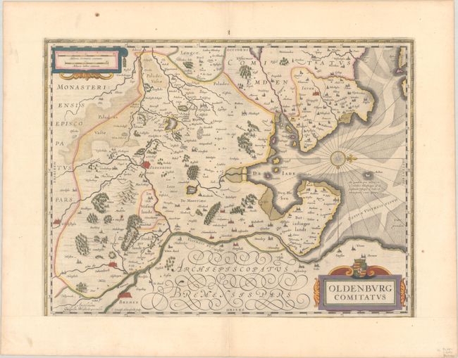
This highly decorative and very attractive map of the vicinity of Oldenburg and Bremen shows the Jadebusen and the estuary of the Weser. The topography and towns are beautifully detailed with nice representations of the forests and river system. The map is oriented with north to the right by a nice compass rose. The map was beautifully engraved by Everard Simonsz Hamersveldt, who worked for all the important cartographic publishers of the period including Hondius, Jansson, Blaeu and Speed. German text on verso, published between 1641-70.
References: Van der Krogt (Vol. I) #2320:2.2.
Condition: B+
A dark impression with full contemporary color on a bright sheet with a small paper flaw in the image at left and a bit of soiling in the blank margins. The sheet was remargined at bottom with loss of the bottom edge of the border; this was likely done by the original bookbinder as the toning along the edges of the sheet (including the remargined portion) is consistent througout.