Subject: Central Europe
Period: 1809 (dated)
Publication:
Color: Hand Color
Size:
31.8 x 28.7 inches
80.8 x 72.9 cm
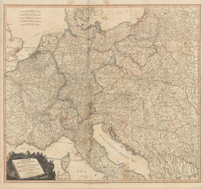
This wall-sized map depicts the theater of war during the Napoleonic Wars and shows most of Europe from France to parts of Eastern Europe and the Balkans. There is emphasis on the boundaries between political entities and the roads that connect cities throughout Europe, with a key distinguishing between roads that are single post, post and a half, and double post in size. Germany and Austria are labeled in bold, decorative letters that stretch across much of central and eastern Europe. As noted in the title, Poland is "dismembered" into Prussia and the Duchy of Warsaw, the latter of which had been established as a French client state by Napoleon Bonaparte in 1807. The decorative title cartouche features the title engraved on a large slab of stone with a crowned German eagle sitting upon it. Printed on two sheets, joined as issued.
References:
Condition: B
A dark impression with contemporary color, issued folding with moderate offsetting, some toning along one vertical fold, and light soiling. There are archival repairs to several short fold separations.