Subject: Portugal
Period: 1632 (circa)
Publication: De Vyerighe Colom
Color: Black & White
Size:
20.7 x 15.2 inches
52.6 x 38.6 cm
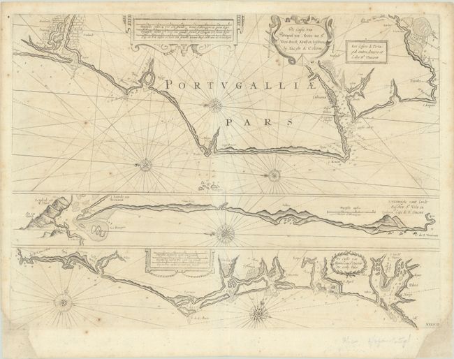
This sheet includes three charts of the coast of Portugal. The first is oriented with north to the left and extends from Aviero, past Lisbon, to Cabo Espichel. The second is also oriented with north to the left and extends from Setubal to Cabo de Sao Vicente, at the southwestern tip of Portugal. The third is oriented with north approximately to the top of the chart and depicts the southern coast of Portugal from Cabo de Sao Vicente to Huelva, Spain. Each chart details the mouths of rivers, depth soundings, safe anchorages, shoals, and the locations of coastal cities. The sheet includes several strapwork cartouches, compass roses, and an alternate French title on the upper chart: "Les Costes de Portugal entre Aveiro et Cabo St. Vincent."
Jacob Aertsz Colom was the founder of the Colom publishing company. He founded the Navigation School in Amsterdam, and published a number of fine sea charts, coasting pilots and a small atlas of Belgium and The Netherlands. Colom's maps and charts are quite rare.
References: Koeman, Col 7 #39.
Condition: B
There is light, scattered foxing with professional repairs to chips in the bottom corners of the sheet, with a small amount of the neatline and one rhumb line replaced in facsimile.