Catalog Archive
Auction 206, Lot 471
"Nieuwe Kaart der Platte Grond van de Stad Parys en Derzelver Voorsteden...", Tirion, Isaac
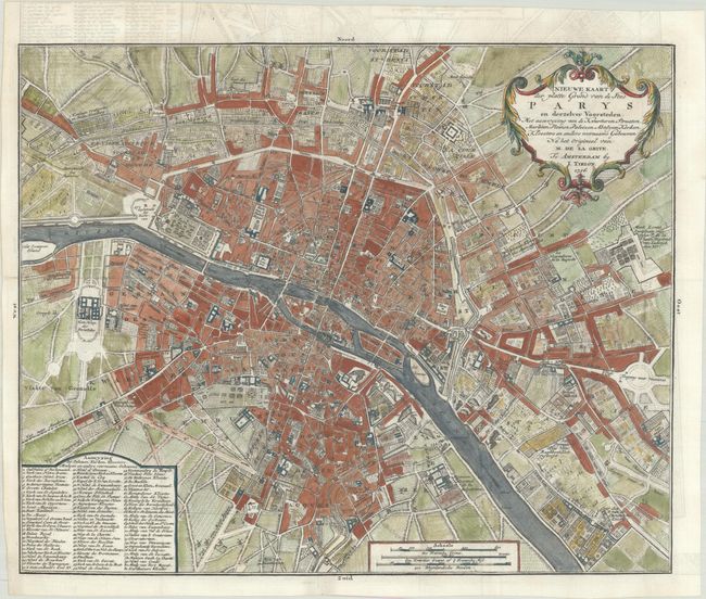
Subject: Paris, France
Period: 1756 (dated)
Publication: Hedendaagsche Historie
Color: Hand Color
Size:
15 x 12.3 inches
38.1 x 31.2 cm
Download High Resolution Image
(or just click on image to launch the Zoom viewer)
(or just click on image to launch the Zoom viewer)