Subject: Northern France
Period: 1646 (circa)
Publication: Atlas Novus
Color: Hand Color
Size:
20.5 x 15 inches
52.1 x 38.1 cm
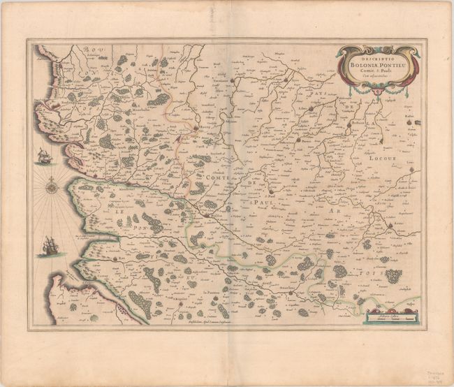
This attractive map of the coast of Artois features the fortified cities of St. Valery-sur-Somme, Le Crotoy, Rue, Estaples, and Boulogne-sur-Mer and extends inland to include Arras and Lens. Adorned by two ships in the English Channel and decorative strapwork title and distance scale cartouches. Latin text on verso, published between 1646-57.
References: Van der Krogt (Vol. I) #4130:1C.1.
Condition: B+
A dark impression with full contemporary color on a sheet with minor toning and light printer's ink residue. There are a couple of short tears along the edges of the sheet, well away from map image. The light gray shadow along the centerfold is caused by our scanner and doesn't appear on the map itself.