Subject: Western & Central Europe
Period: 1644 (circa)
Publication: De Rebus Publicis Hanseaticis
Color: Hand Color
Size:
14.1 x 10.3 inches
35.8 x 26.2 cm
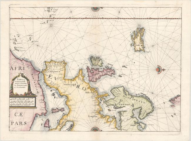
This rare map of western and central Europe is oriented with north to the right and extends to include Iceland, Spitsbergen and northern Africa. The interior of the continent is blank, with only a few place names noted along the coasts. The Prime Meridian runs through the Azores Islands. Decorated with three half compass roses, rhumb lines, and a decorative title cartouche. Engraved by Merian after Willem Blaeu's similar chart, and published in Johann Angel von Werdenhagen’s De Rebus Publicis Hanseaticis.
References: Shirley (BL Atlases) G.Werd-1a #133.
Condition: B+
A crisp impression on a bright, watermarked sheet with a printer's crease adjacent to the centerfold and several worm tracks along the centerfold at top that have been archivally infilled.