Subject: Western Netherlands
Period: 1680 (circa)
Publication:
Color: Hand Color
Size:
22 x 18.2 inches
55.9 x 46.2 cm
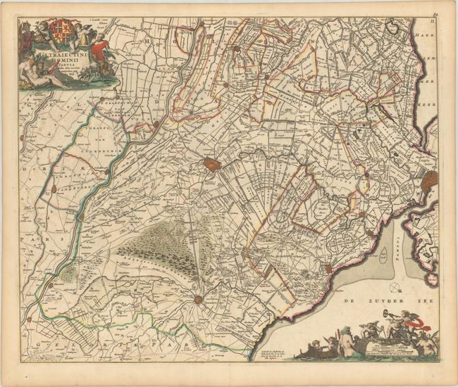
This large, bold map is centered on Utrecht, and shows the countryside reaching to Amsterdam, Amersfoort and Schoonhoven. It presents a fabulous view of the extensive canal systems and polders of the region. The map is decorated with a figurative cartouche topped with a coat of arms and scale of miles surrounded with cherubs and merfolk. A small compass rose orients the map with north in the lower right corner. This is the third state of the map with new place names to the east of Amersfoort (Neer, Zeldert, Eemlanden, etc.), where land was reclaimed from the sea bed.
References: Carhart #125.3.
Condition: B+
A nice impression with some scattered foxing and light offsetting.