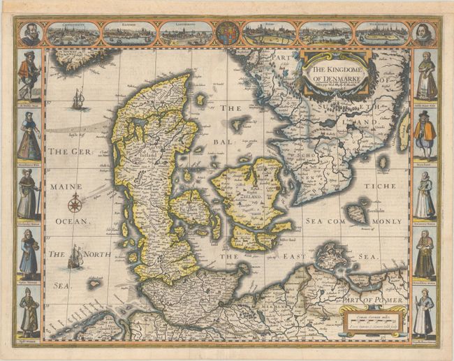
Subject: Denmark & Southern Sweden
Period: 1626 (dated)
Publication: A Prospect of the Most Famous Parts of the World…
Color: Hand Color
Size:
19.9 x 15.5 inches
50.5 x 39.4 cm
This superb map of the Kingdom of Denmark covers the region that includes Terra Scania on the southern coast of present-day Sweden and Schleswig-Holstein. This is one of only three carte-a-figures map of Denmark. The top panel includes the portraits of King Christian IV and King Frederick III, the royal coat of arms and bird's-eye views of notable places including Copenhagen, Elsinore, Landscroon, Ripe, Schleswig and Hamburg. The side borders illustrate different levels of Danish society with costumed figures. On the verso is English text containing a description of the kingdom. This is an early edition with the imprint of George Humble in Popshead Alley in the cartouche, published between 1627-32. Engraved by Evert van Hamersveldt Symons.
References: Shirley (BL Atlases) T.SPE-2a #15.
Condition: A
A dark impression on a bright sheet with a fleur-de-lis atop a coat of arms watermark and a bit of printer's ink residue in the North Sea. Remargined at top with old paper to accommodate framing, and there is a professionally repaired tear at bottom center that enters less than 1/2" into the image.