Subject: Baltic Sea
Period: 1773 (circa)
Publication:
Color: Black & White
Size:
35.4 x 24.1 inches
89.9 x 61.2 cm
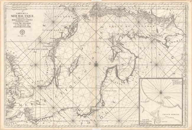
This superb, large sea chart of the Baltic Sea is filled with detail along the coastlines including mountains, cities, and forests. A large inset at bottom right depicts the harbor and entrance to the city of Dantzig. The map is centered on a compass rose with radiating rhumb lines. This chart was initially created for Jaillot's Neptune Francois in 1693 and subsequently was incorporated into publications by Bellin for the Depot de la Marine. Engraved by Herman van Loon, whose imprint appears adjacent to the inset. The seal of the Depot de la Marine and the price, Prix. trente Sols, appear below the title. An uncommon chart.
References: cf. Pastoureau, NEPTUNE FRANCAIS A [2].
Condition: B+
A dark impression on watermarked paper with light toning along the centerfold, a few light spots, and a short printer's crease at top. There is some minor printer's ink residue and remnants of hinge tape in the the top and bottom blank margins on recto.