Subject: Baltic & Southern Scandinavia
Period: 1721 (circa)
Publication: Atlas Nouveau...
Color: Hand Color
Size:
23.8 x 17.6 inches
60.5 x 44.7 cm
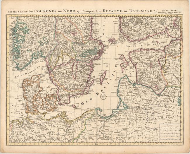
This handsome and intricately detailed map is the southern sheet of a two-sheet map of Scandinvia and the Baltic, but it stands alone with its own borders. It shows the nations surrounding the Baltic Sea, stretching from the southern tips of Norway and Sweden to the northern part of Poland. There is excellent detail of watershed and several towns and cities are located, including Oslo, Gothenburg, Copenhagen, Hamburg, Berlin, Gdansk, Vilnius, Riga, and Helsinki. The map is a Covens and Mortier re-engraving of Delisle's work. Second state, with both Covens and Mortier's name in the imprint.
References: Shirley (BL Atlases) T.COV-1a; Van Egmond (Covens & Mortier) #19.2.
Condition: A
A sharp impression with contemporary outline color. There are a few minor spots in the map image and a couple of short tears confined to the bottom blank margin. Remnants of old tape appear along the edges on verso.