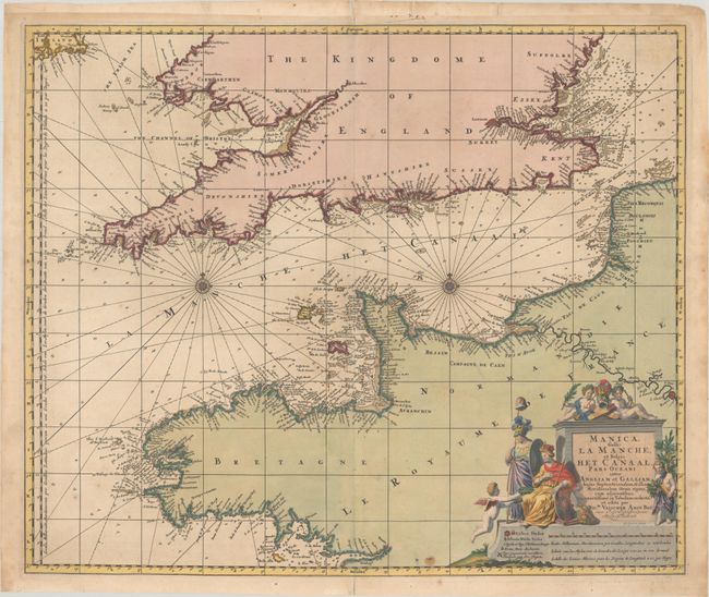
Subject: English Channel
Period: 1698 (circa)
Publication:
Color: Hand Color
Size:
22.6 x 18.8 inches
57.4 x 47.8 cm
This large-scale chart centers on the English Channel and details the coastline of southern Britain and northern France. In England & Wales the map extends as far north as Suffolk and Pembrokeshire, and inland to London on the Thames. In France the chart extends south to Brittany, and inland to Paris on the Seine. Just the southern tip of Ireland is included. There is great navigational information with soundings, shoals, and anchorages. The chart includes two compass roses and rhumb lines. The allegorical title cartouche features a royal figure holding the coat of arms of King William III of England and a female figure holding a staff with the liberty cap. Engraved by Gilliam Gouwen.
References: Koeman, Visscher [198].
Condition: B+
A crisp impression with full contemporary color on a sheet with the watermark of Pieter van der Ley. There is minor toning, a few small spots, and some stains along the edges of the sheet. The top margin has been extended with old paper, which has begun to come loose, and there is an archivally repaired tear that enters less than 1" into the image at top.