Current Auction
Lot 418
Current Auction

"Tabula Maris Septentrionalis", Merian, Matthaus
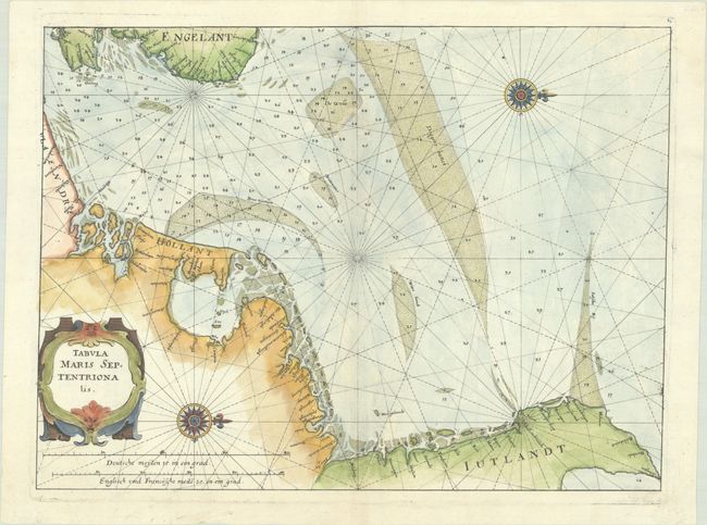
Subject: North Sea

Period: 1644 (circa)

Publication: De Rebus Publicis Hanseaticis

Color: Hand Color

Size:
13.9 x 10.3 inches
35.3 x 26.2 cm
Download High Resolution Image
(or just click on image to launch the Zoom viewer)

This handsome and rare chart details the North Sea between England and the Netherlands and is oriented with north to the right. The Frisian Islands are shown along the coast of Holland to just south of Dunkerque. There are a number of place names along the coasts. Decorated with two compass roses, rhumb lines, and a decorative title cartouche. Engraved by Merian and published in Johann Angel von Werdenhagen’s De Rebus Publicis Hanseaticis.

References: Shirley (BL Atlases) G.Werd-1a #134.

Condition: A+

A crisp impression on a bright sheet with a dragon watermark.

Estimate: $200 - $230

Current High Bid:
$0

Reserve: Reserve Not Met
Next Bid: $100

Bid Increments
$100 - $249$10
$250 - $499$25
$500 - $999$50
$1,000 - $2,499$100
Terms & Conditions