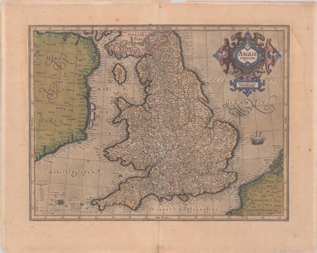
Subject: England & Wales
Period: 1609 (circa)
Publication: Gerardi Mercatoris - Atlas sive Cosmographicae
Color: Hand Color
Size:
18.3 x 13.9 inches
46.5 x 35.3 cm
This attractive map of Elizabethan England uses names taken from Saxton's map of 1579. County boundaries and their Latinized names are shown. The map is beautifully engraved in Mercator's characteristic style with a stipple engraved sea with a sailing ship, bold calligraphy and a handsome title cartouche. French text on verso, published in 1609 or 1619.
References: Shirley (BI to 1650) #181; Van der Krogt (Vol. I) #5100:1A.1.
Condition: B+
Full contemporary color on a lightly toned sheet with the coat of arms watermark of Marten Orges. There are a few spots of foxing and old paper repairs to several separations along the centerfold and a few tiny tears along the edges of the sheet.