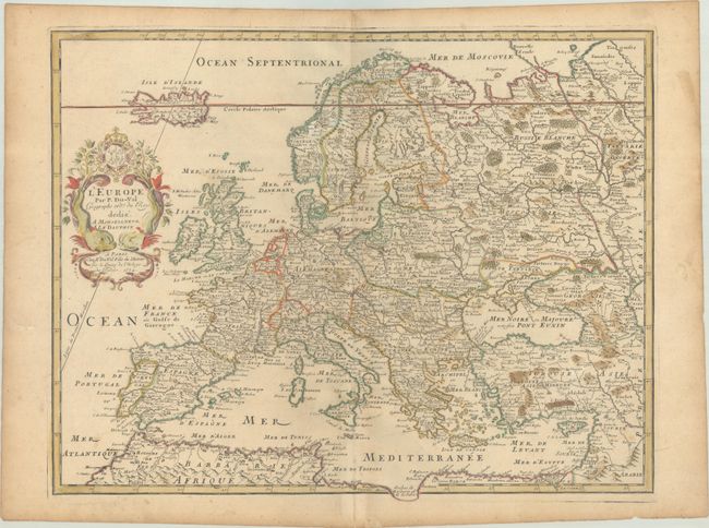
Subject: Europe
Period: 1684 (dated)
Publication:
Color: Hand Color
Size:
20.2 x 15.6 inches
51.3 x 39.6 cm
This rare map of the continent is filled with detail, including hundreds of towns, rivers, mountains, forests, and political boundaries. Politically, Central and Eastern Europe are controlled by three entities: Germany, Poland and the Ottoman Empire. The map extends to include Iceland and the western shore of the Caspian Sea. Adorned with a decorative cartouche that is flanked by a pair of sea monsters. Dated 1684 but published circa 1697 by Pierre Duval's daughter.
References:
Condition: B+
Contemporary outline color in the map with later color in the cartouche, on a lightly toned sheet with a large coat of arms watermark. There is light soiling that is mostly confined to the edges of the sheet and a couple of short edge tears that have been archivally repaired on verso.