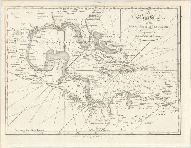
Subject: Gulf of Mexico & Caribbean
Period: 1795 (dated)
Publication: Malham's Naval Gazeteer
Color: Black & White
Size:
9.4 x 6.9 inches
23.9 x 17.5 cm
This small but detailed chart centers on the Gulf of Mexico and Caribbean. The southern United States is shown, including Texas (where the Cenis Indians are noted as well as a settlement named Texas), East and West Florida, and Georgia. Mexico, Central America, and northern South America appear in nice detail as well. Towns and cities, major rivers, Indian tribes, bays, and more are located. The islands of the Caribbean are named, with a note above Guanaliani or Salvador (San Salvador Island) referring to Columbus's landing in 1492. Rhumb lines fill the waters. The chart was engraved by Neele for Rev. John Malham (1747-1821), a writer and teacher of navigation, for Malham's The Naval Gazetteer; or, Seaman's Complete Guide.
References: McCorkle (18th C. Geography Books) #251, Vol. I-10.
Condition: A
A crisp impression issued folding with a couple short wormtracks in the left margin, one of which just enters neatline.