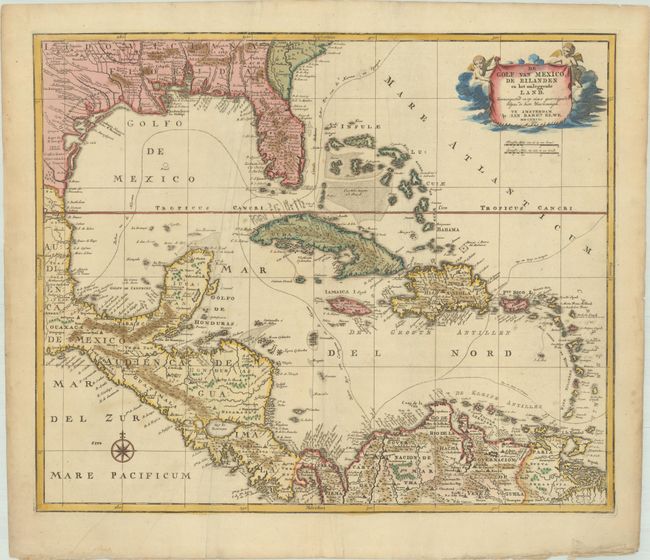
Subject: Gulf of Mexico & Caribbean
Period: 1792 (dated)
Publication:
Color: Hand Color
Size:
22.8 x 18.9 inches
57.9 x 48 cm
This uncommon chart covers the Gulf of Mexico and the Caribbean including Florida, Central America, and the northern part of South America. It provides good detail including several Indian place names in Louisiana and Florida. The Mississippi River is boldly shown and New Orleans is curiously missing. The routes of the Spanish galleons are prominently noted. The map is decorated with a compass rose and a title cartouche held aloft by putti.
References: Phillips (Atlases) 674-39.
Condition: B+
A nice impression with contemporary color in the map and later color in the cartouche, on a sheet with a pair of elephant watermarks. There are several printer's creases and extraneous creases, two tiny holes in the image (within the Bahamas), and marginal soiling.