Catalog Archive
Auction 206, Lot 292
"Map Showing the Distribution of the Indian Tribes of Washington Territory Compiled from the Latest Authorities to Illustrate a Paper by the Late Geo. Gibbs", U.S. Department of Interior
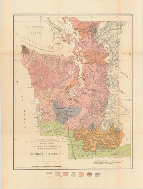
Subject: Washington
Period: 1876 (dated)
Publication: Contributions to North American Ethnology, Volume I
Color: Printed Color
Size:
15.6 x 20.1 inches
39.6 x 51.1 cm
Download High Resolution Image
(or just click on image to launch the Zoom viewer)
(or just click on image to launch the Zoom viewer)