Subject: Vermont
Period: 1861 (dated)
Publication: Report on the Geology of Vermont
Color: Hand Color
Size:
17.2 x 25.3 inches
43.7 x 64.3 cm
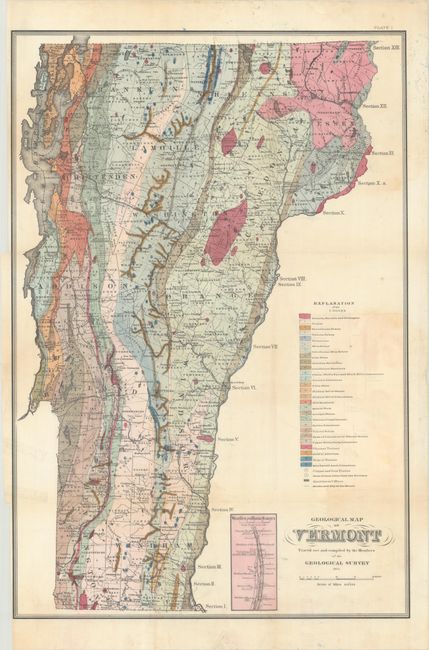
A very detailed and colorful map from A.G. Hager's report. The map was compiled by members of the Vermont Geological Society, which continue operating today. It has an extensive legend that locates 27 different geological types through both color and pattern. The map also locates copper and iron pyrites, ores of iron older than the Tertiary, quarries and mines, and arrows that indicate the strike and dip of the underlying strata. Interestingly, the society printed a different legend and pasted it down over the original. An inset "West Rutland Marble Quarries" locates and names numerous quarries.
References: Marcou & Marcou #216.
Condition: B+
Issued folding with some light toning. There are binding trims at left and two 1" edge tears also at left that have been closed on verso with tape. Updated legend has been pasted over the original, as issued.