Subject: Dallas, Texas
Period: 1955 (dated)
Publication:
Color: Printed Color
Size:
26.6 x 32 inches
67.6 x 81.3 cm
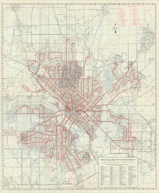
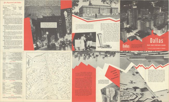
This locally produced map of the city by J.M. Doyle was published on behalf of the Dallas Chamber of Commerce and sold by Hugh Sellers Co. The map extends from Richardson south to Fruitdale and from Cockrell Hill to east of White Rock Lake. It locates roads, railroads, rivers, parks, golf courses, and more. Streetcars and bus routes are shown in red overprinting with a key identifying routes at bottom right. The verso features a small map of downtown, photographic illustrations, and a large street index. Self-folding into pictorial wrappers (4.0 x 8.2") with a view of the Dallas skyline at night.
References:
Condition: A
Issued folding on a clean sheet with a short archivally repaired fold separation along the right sheet edge.