Subject: Texas
Period: 1884 (dated)
Publication: Mitchell's New General Atlas
Color: Hand Color
Size:
21.4 x 14.4 inches
54.4 x 36.6 cm
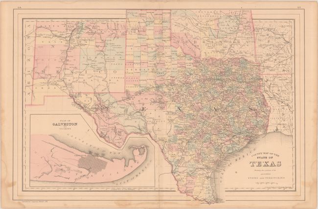
This double-page map of Texas extends to include parts of New Mexico, Oklahoma, Arkansas and Louisiana. The map presents an excellent view of the county development with only the large regions of West Texas yet to be organized. Galveston’s role as a main port of entry is implied by the large inset of the Plan of Galveston and Vicinity. The Llano Estacado or Staked Plain, is shown extending from the New Mexico Territory through the Texas Panhandle. Numerous railroads serve the southeastern part of the state. Indian Territory is divided into several large nations and reservations. Drawn and engraved in Philadelphia by W. H. Gamble.
References: Rumsey #0592.031.
Condition: B+
There is a 2"centerfold separation at bottom that has been repaired with tape on verso, a few spots of foxing, and light dampstaining that is mostly confined to the blank margins.