Subject: Oregon, Atlases
Period: 1878 (published)
Publication:
Color: Hand Color
Size:
14.5 x 17.6 inches
36.8 x 44.7 cm
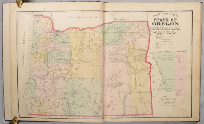
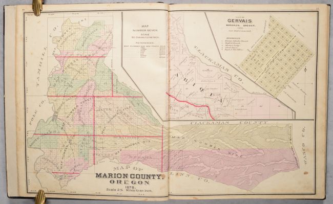
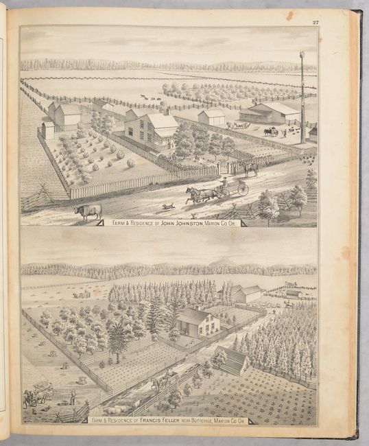
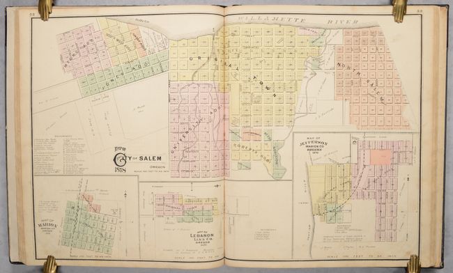
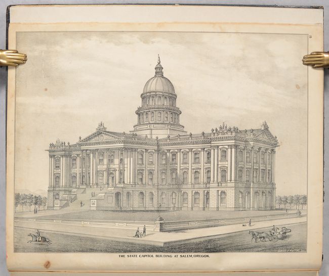
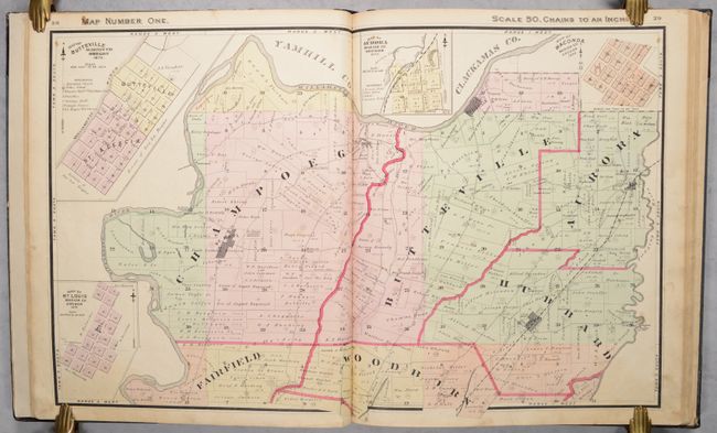
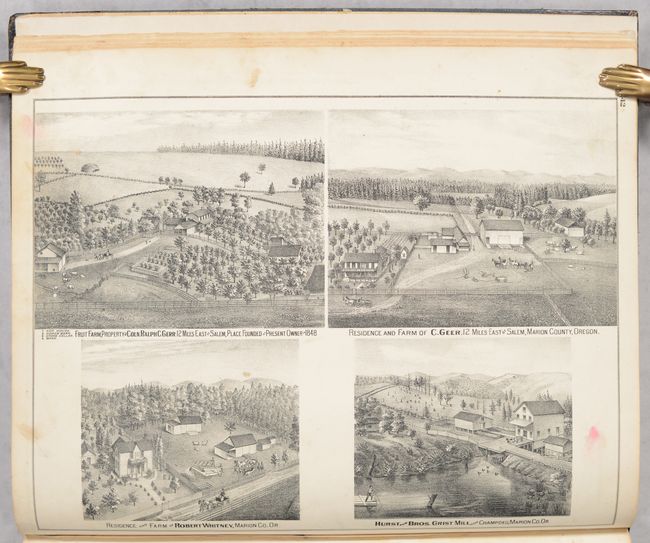
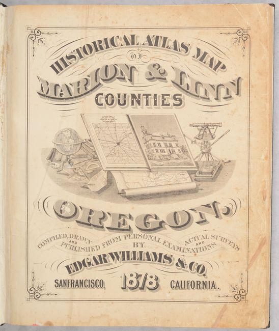
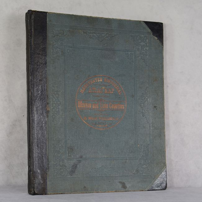
This attractive and informative atlas was produced by Edgar Williams & Co. in San Francisco, and was the first county atlas published for Oregon. It contains a total of 19 double-page maps, including a general map of the state as well as index maps for Marion and Linn counties. The maps depict the various townships within the counties showing highly detailed land ownership, roads, railroads, creeks, rivers, and more. Also includes maps of the street-grid pattern of Salem and Albany. Augmenting the maps are numerous lithographic illustrations showing important residences, farms, public buildings, and more that give a wonderful snapshot of life at this time. A 17-page history of the counties provides additional context to the illustrations. Hardbound in black quarter leather with tips over green cloth boards with gilt title on the front cover. This example includes the original order slip of the book's first owner, Robert Harrison, an English farmer residing in Linn County.
References: Rumsey #5056.
Condition: B
The maps range from B+ to B condition, with light to moderate soiling and staining and some short edge tears, typically along the margins at bottom. Title page has some extraneous creasing and repairs in the corners. New endpapers have been inserted at front and back. Rebacked with original spine backstrip and covers, which have moderate shelf wear and staining.