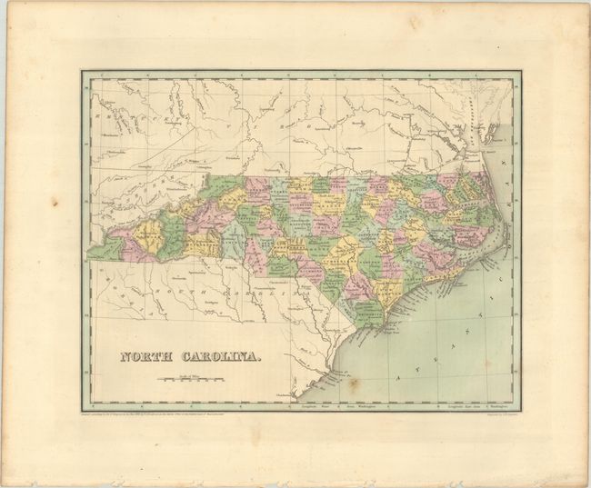
Subject: North Carolina
Period: 1838 (dated)
Publication: An Illustrated Atlas, Geographical, Statistical, and Historical, of the United States...
Color: Hand Color
Size:
14.4 x 11.3 inches
36.6 x 28.7 cm
A fine map of the state with 66 counties and excellent detail throughout. County configurations are current to 1837, prior to the creation of Henderson County in 1838. Two railroads are shown leading from Richmond and Norfolk to Raleigh and Wilmington, and the University of North Carolina is noted at Chapel Hill. Much of the eastern part of the state is illustrated as marsh and wetlands, with both an Alligator Swamp and Alligator Lake in Hyde County. This map should not be confused with the more common maps from Bradford’s Comprehensive Atlas - it is several inches larger and carries much more information. Engraved by G.W. Boynton.
References: Phillips (Atlases) #1381; Ristow pp. 270-271.
Condition: B+
Full contemporary color with some minor foxing in the lower image. There are binding holes in the bottom margin.