Subject: Brooklyn, New York
Period: 1890 (circa)
Publication:
Color: Hand Color
Size:
23.3 x 32.7 inches
59.2 x 83.1 cm
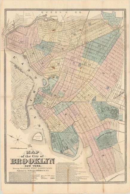
Rare, large pocket map of Brooklyn showing the streets, railroads and city docks, extending to show the southeastern tip of Manhattan. It is colored by ward with the city parks and cemeteries also highlighted. Interestingly, this map distinguishes between the Horse Car Railroad, Steam Car Railroad, and Elevated Railroad, with the routes listed below the title. The date of the map is based on the four main lines depicted of the Elevated Railroad, which were completed in 1890. The map is surrounded by a decorative border. Photolithography by Robert A. Welcke. Original boards are no longer present. Matthew Dripps, an Irish immigrant, published maps of the vicinity of New York City in the latter part of the 19th century. He was instrumental in publishing detailed urban maps that are notable for their distillation of information.
References:
Condition: B
Issued folding with contemporary color, toning along a few folds, and several small stains. There are archival repairs to a number of fold separations and to a few holes at fold intersections.