Subject: Colonial Saratoga, New York, Revolutionary War
Period: 1780 (dated)
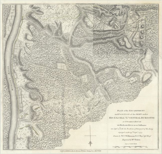
Publication: A State of the Expedition from Canada…
Color: Hand Color
Size:
13.4 x 12.6 inches
34 x 32 cm
This detailed and uncommon battle plan shows the placement of British and American forces during the first part of the Battle of Saratoga (also called the Battle of Freeman's Farm) in September of 1777. The two battles were fought nineteen days apart and were a critical turning point in the war. After the Americans' triumph over General John Burgoyne's troops, Louis XIV officially recognized the revolutionary effort and began offering military aid. France's involvement turned the American Revolution into a global conflict. The map is from John Burgoyne's A State of the Expedition from Canada..., published in London. This example includes the fascinating overlay at top right that shows the troops' positions after the battle. These overlays were located at the end of the atlas and could be hinged to the map. Faden's maps of the American Revolution are particularly well presented because he based them on manuscript maps supplied to him from the war zone.
References: Nebenzahl (Biblio) #53; Nebenzahl (American Revolution) #20; Phillips (M) p. 835.
Condition: A
Issued folding and now flattened and backed with tissue to repair a few tiny fold separations. There is a bit of printer's ink residue along the fold at bottom left.