Subject: World
Period: 1800 (circa)
Publication:
Color: Black & White
Size:
17.8 x 12.9 inches
45.2 x 32.8 cm
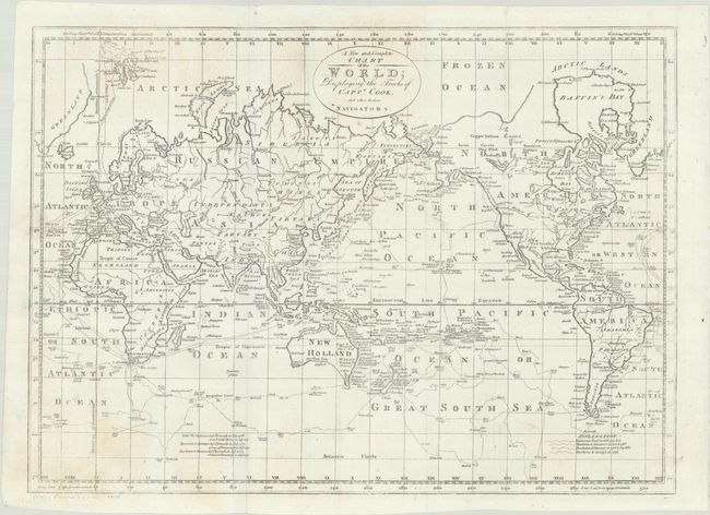
This fascinating map of the world is filled with Captain Cook's tracks from all three voyages. A key at bottom right corresponds the various tracks to each voyage. In North America, there is a fictitious West River, while Alaska is shown with a fairly correct shape. Fou-sang is identified on the northwest coast of North America, which was a mythical Chinese colony allegedly established in the 5th century. The Sandwich Islands are shown and noted as the place where Capt. Cook was killed. The South Pacific is filled with islands, and New Zealand is fully formed. Tasmania is still attached to Australia, which is shown with an incomplete southern coastline. There are numerous detailed notations throughout. This edition of the map removes the "Engraved for Banke's New System of Geography" above the top neatline, though it is still partially visible.
References: Phillips (Maps) p. 1094.
Condition: B+
Issued folding on paper with a fleur-de-lis watermark, dated 1800. There are minor spots and light soiling at bottom left.