Subject: Michigan
Period: 1838 (published)
Publication: An Illustrated Atlas, Geographical, Statistical, and Historical, of the United States...
Color: Hand Color
Size:
11.1 x 14.3 inches
28.2 x 36.3 cm
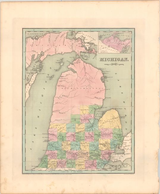
A nice copper engraved map of the state issued just one year after statehood. Counties are individually hand colored, including the large Michilimackinac (Mackinac) and Chippewa counties in the northern half of the state. County development is current to the published date, with the addition of Ingham County in the south-central part of the state. Development is confined mostly to the southern portion of the state, including railroads extending from Detroit to Marshall and Tecumseh. This map should not be confused with the more common maps from Bradford’s Comprehensive Atlas - it is several inches larger and carries much more information. Engraved by G.W. Boynton.
References: Phillips (Atlases) #1381; Ristow pp. 270-271.
Condition: A
Full contemporary color with minor foxing and soiling in the blank margins.