Subject: Northern Illinois, Mississippi River
Period: 1837 (dated)
Publication: Sen. Doc. 139, 25th Congress, 2nd Session
Color: Black & White
Size:
64.5 x 18 inches
163.8 x 45.7 cm
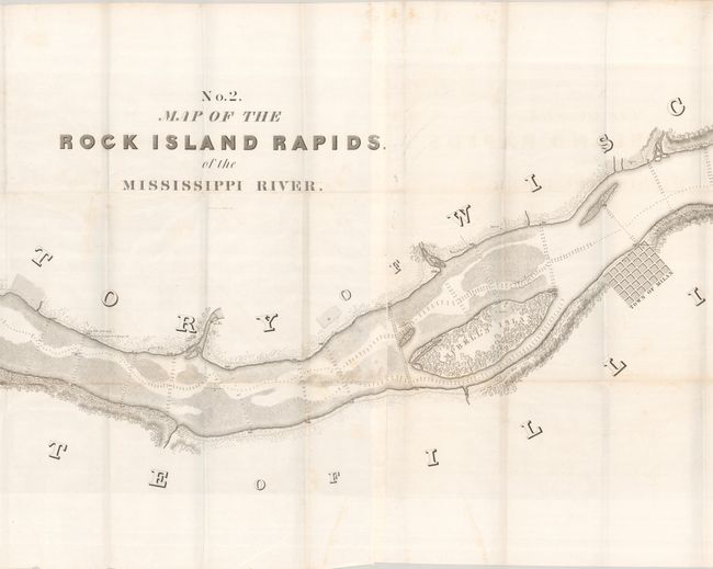
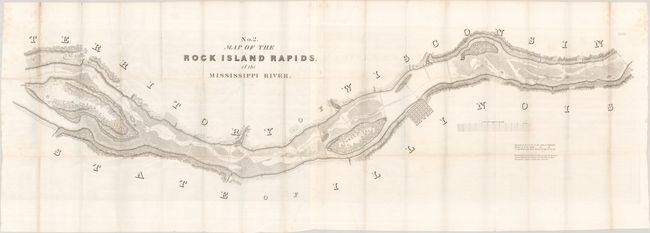
Robert E. Lee surveyed and produced three maps of the Mississippi River in 1837. This one covers that portion of the river in the vicinity of Milan, Illinois and includes a street plat of the city with only a few buildings noted. Locates Davenport's, Campbell's and Rock Island in the river, with Fort Armstrong and Davenport named on Rock Island. Roads and vegetation follow the course of the river, which is filled with numerous soundings. Drawn on a scale of 16 chains (about 1,000 feet) per inch. Surveyed by Lee in his early years as part of the Corps of Engineers. Engraved by W.J. Stone in Washington.
References: Claussen & Friis #190.
Condition: A
Issued folding on a bright sheet with some minor foxing along the left and right sheet edges. The map is in remarkable condition for its size.