Subject: Illinois
Period: 1838 (published)
Publication: An Illustrated Atlas, Geographical, Statistical, and Historical, of the United States...
Color: Hand Color
Size:
11.1 x 14.3 inches
28.2 x 36.3 cm
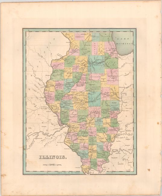
This copper-engraved map presents an early network of (mostly proposed) railroads throughout the state. The National Road is shown connecting Terre Haute with Vandalia and Alton, and the Illinois and Michigan Canal (under construction) is shown linking the Illinois River to Lake Michigan. County configuration is current to the date of the map with the additions of Boone and De Kalb in the northern portion of the state. This map should not be confused with the more common maps from Bradford’s Comprehensive Atlas - it is several inches larger and carries much more information. Engraved by G.W. Boynton.
References: Phillips (Atlases) #1381; Ristow pp. 270-271.
Condition: B+
Full contemporary color with a bit of foxing and staining along the borders.