Catalog Archive
Auction 206, Lot 23
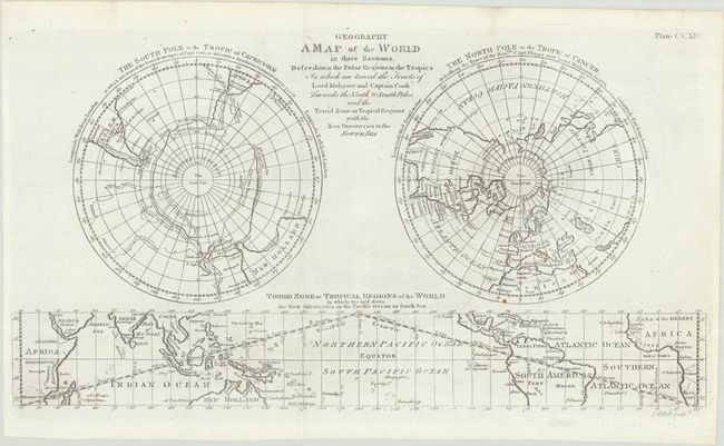
"A Map of the World in Three Sections, Describing the Polar Regions to the Tropics in Which Are Traced the Tracts of Lord Mulgrave and Captain Cook Towards the North & South Poles...", Bell, Andrew
Subject: World
Period: 1786 (circa)
Publication:
Color: Black & White
Size:
16.6 x 9 inches
42.2 x 22.9 cm
Download High Resolution Image
(or just click on image to launch the Zoom viewer)
(or just click on image to launch the Zoom viewer)