Catalog Archive
Auction 206, Lot 226
One of the First Maps to Portray Volcanic Activity in Hawaii
"Chart of the Sandwich Isles", Fisher, H.
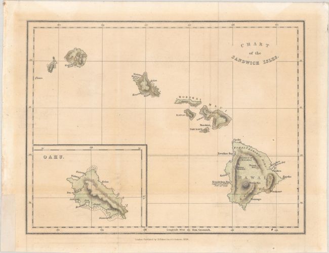
Subject: Hawaii
Period: 1828 (dated)
Publication: Narrative of a Tour Through Hawaii
Color: Hand Color
Size:
9.4 x 7.3 inches
23.9 x 18.5 cm
Download High Resolution Image
(or just click on image to launch the Zoom viewer)
(or just click on image to launch the Zoom viewer)