Subject: Washington, D.C.
Period: 1849 (circa)
Publication: A New Universal Atlas...
Color: Hand Color
Size:
15.7 x 12.5 inches
39.9 x 31.8 cm
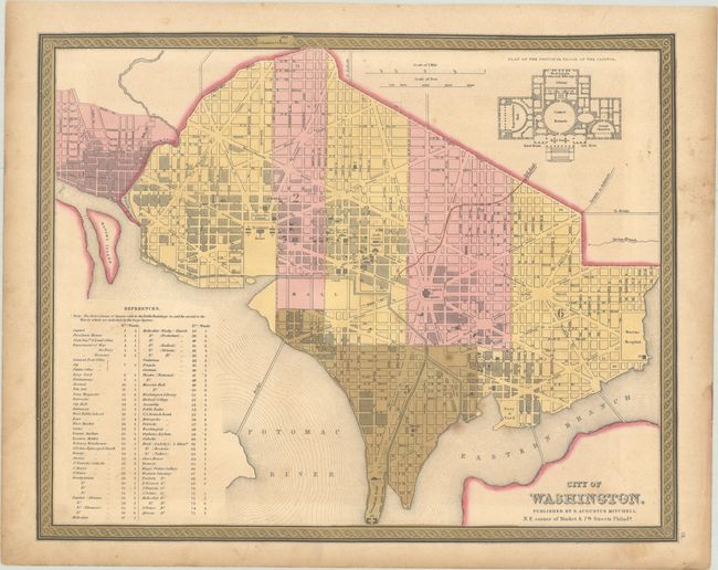
This finely engraved plan of the Capital names all major streets and buildings; notably, the President's House, Capitol Square, the Navy Yard, Judiciary Square and the Patent Office & National Institute. The Mall is mostly blank as construction on the Washington Monument will not start for two years. Also the Smithsonian Institute is not yet mentioned. Extensive table at lower left lists and keys to map 108 important buildings, e.g. the Capitol, State Department, Departments of War, Navy, and Treasury. Decorative scroll-style border. Engraved vignette depicts "Plan of the Principal Floor of the Capitol Building." This map has the Cowperthwaite & Thomas green border with page "16" at lower right outside the neatline.
References:
Condition: B+
Full contemporary color with some minor toning and foxing.