Subject: Monterey Bay, California
Period: 1852 (dated)
Publication:
Color: Black & White
Size:
11.8 x 13.3 inches
30 x 33.8 cm
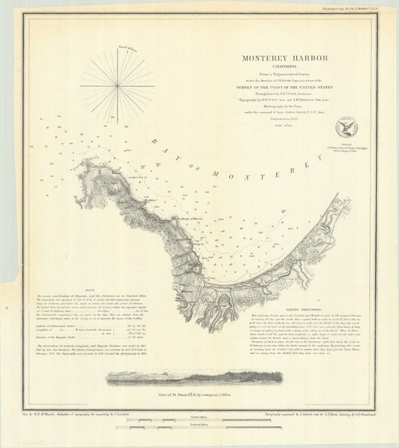
This detailed chart from the important coastal survey of Monterey Bay features a plan of the town and fort. A church, custom house, ruins of a fortified Mexican battery, Point Pinos, Pt. Anlon, Pt Almejor Mussell, a lagoon, and the cemetery are located. It extends to Point Pinos, now the location of Pacific Grove and part of the famous 17 Mile Drive, with a small coastal profile of Pt. Pinos across the bottom. The chart includes extensive sailing directions, a simple compass rose, two distance scales, and the official seal of the Coast Survey Office. The topography was reduced for engraving by J. Lambert and engraved by S. Siebert, the views were completed by S.V. Hunt and W.B. McMurtrie, and the lettering by E.F. Woodward.
References:
Condition: A
Issued folding on a clean sheet with a pair of light creases in the bottom corners.