Subject: California
Period: 1914 (dated)
Publication:
Color: Printed Color
Size:
19.8 x 25.3 inches
50.3 x 64.3 cm
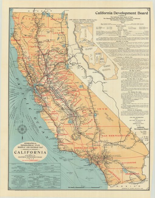
This map is delineated by county and illustrates the state's infrastructure including highways, railroads and shipping routes. An unusual inset map at top right visually demonstrates how 10 other states would easily fit within California's footprint, and a large table describes the California Development Board, which was in its fifth year of operation at the time of publication. The Development Board was formed by merging the California State Board of Trade (established in 1890), the Manufacturers and Producers Association of California, and the California Promotion Committee. Its primary mission was to promote immigration and tout the state's economy. Lithographed by Britton & Rey in San Francisco and published by the Development Board.
References:
Condition: A+
Clean, bright and fine. Issued folding on thin banknote-style paper.