Subject: Alaska
Period: 1875 (dated)
Publication: Contributions to North American Ethnology, Volume I
Color: Printed Color
Size:
31 x 22.1 inches
78.7 x 56.1 cm
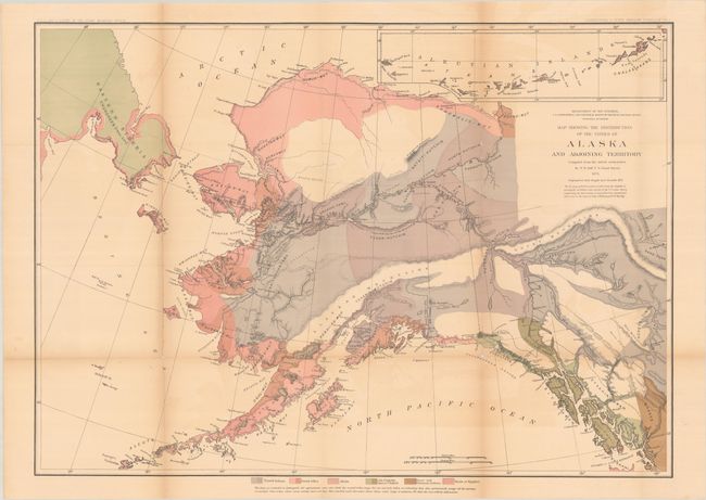
This large and colorful ethnologic map focuses on the Native American tribes of Alaska, the Siberian Peninsula, and part of today's Yukon Territory. Color overprinting and line locate the territories of the six tribal groups in Alaska, and part of British Columbia: Tinneh Indians; Innuit tribes; Aleuts; Asia Chukhis American Tlinkets; Nasse and Chimsyan Indians; and Haida or Kygahni. Individual tribes are named within the groups. A large inset at upper right continues the Aleutian Islands. Compiled by W.H. Dall, U.S. Coast Survey with the geographical data brought up to November 1875. Published by the Bureau of Ethnology, a short-lived agency, that was renamed the American Bureau of Ethnology in 1897 and eventually merged with the Smithsonian Institution in 1965. This is an uncommon map that we have encountered only once before.
References:
Condition: B
Issued folding with light toning and color offsetting and numerous fold separations that have been mostly closed on verso with archival tape. There is minute loss at a couple of fold junctions.