Subject: Northern California & Western Nevada
Period: 1880-81 (dated)
Publication: U.S. Geographical Surveys West of the 100th Meridian
Color: Printed Color
Size:
18.6 x 15.1 inches
47.2 x 38.4 cm
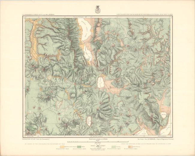
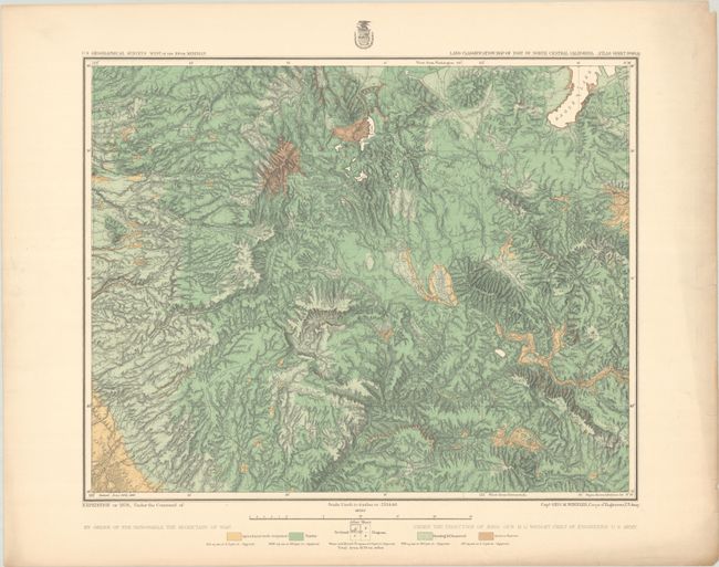
The 1870s was a period of intense effort, by such prominent people as Clarence King, Ferdinand Hayden, and John Wesley Powell, to advance the geographical knowledge of the West. These various surveys presented a threat to the Army's supremacy in the field of mapping and to the related appropriations from Congress. As a result of these pressures, the Army Corp of Engineers developed a plan to systematically survey the entire West to be called the U.S. Geographical Surveys West of the One Hundredth Meridian. The region was divided up into 95 rectangles, with atlas sheets to be prepared for each, comprising an area 2°45' of longitude and 1°40' of latitude on a scale of eight miles to the inch. Lieutenant George Wheeler was chosen to head this immense project. Surveys were conducted each summer from 1872 to 1878, after which Congress cut off appropriations for field work; thus the survey was not completed as originally envisioned. Wheeler published annual reports from 1873 to 1884, as well as the final Geographical Report published in 1889. The maps from this report are a valuable document of the record of Western exploration.
These two maps are from Wheeler's series of maps showing land classification by type including Agriculture, Timber, and Grazing, and Arid/Barren. Each shows fine detail of mountain ranges, river systems, and early settlements. The first map extends from Fredonyers Peak north to Alturas and east to Division Peak. It locates an Old Emigrant Road and Old Spruce Valley and Mill City Road. The second map extends from the northern Sacramento Valley east to Quincy, Susunville and Eagle Lake. Various trails, roads and creeks are intewoven amongst the rugged topography. Finely colored in green, yellow and ochre with varying line. On a detailed scale of 4 miles per inch.
References: Phillips (Atlases) #1281-44 & 50.
Condition: A
Crisp impressions with attractive coloring. There are a few short edge tears confined to the blank margins, and the second sheet has some minor toning along the sheet edges.