Subject: Western United States, Washington
Period: 1898-99 (dated)
Publication:
Color: Printed Color
Size:
8 x 11.5 inches
20.3 x 29.2 cm
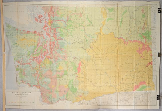
This attractive portfolio atlas was issued as a companion volume housing eight folding maps related to the 20th Annual Report Forest Reserves text volume (not present). Of particular interest is the massive Map of Washington Showing Classification of Lands (61.8 x 41.1") that is printed on four joined sheets. The map derives its bright color from nine different classifications of land based on the forest density. Other details include towns, villages, roads, railroads, watershed, topography and coastal detail. The large Jefferson Forest Reserve occupies the northern portion of the Olympic Peninsula and the Rainier Forest Reserve surrounds Mt. Rainier. The full list of maps includes:
A. [On 4 Joined Sheets] Map of Washington Showing Classification of Lands, by George H. Plummer, F.G. Plummer, and J.H. Rankine, dated 1898 (61.8 x 41.1").
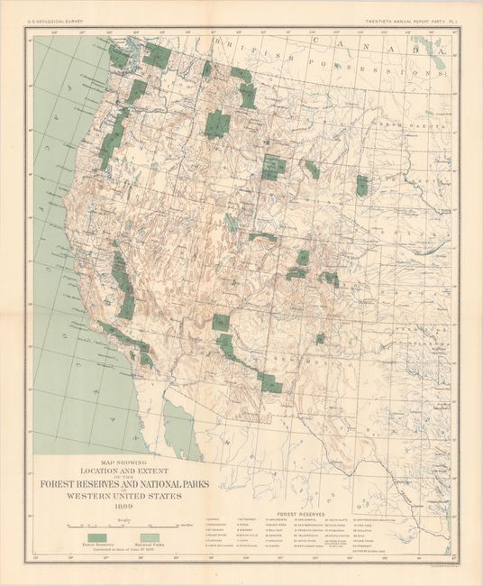
B. Map Showing Location and Extent of the Forest Reserves and National Parks in Western United States, dated 1899 (14.4 x 17.7").
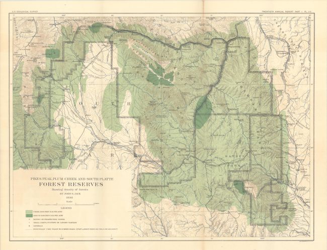
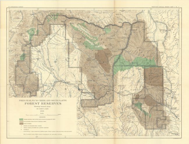
C. Pikes Peak, Plum Creek and South Platte Forest Reserves Showing Density of Forests, by John G. Jack, dated 1898 (20.7 x 15.6").
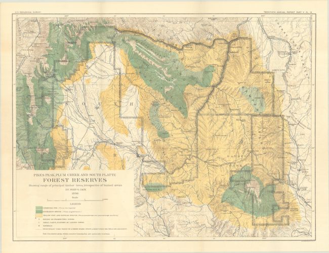
D. Pikes Peak, Plum Creek and South Platte Forest Reserves Showing Range of Principal Timber Trees, Irrespective of Burned Areas, by John G. Jack, dated 1898 (20.7 x 15.5").
E. Pikes Peak, Plum Creek and South Platte Forest Reserves Showing Burned Areas, by John G. Jack, dated 1898 (20.7 x 15.6").
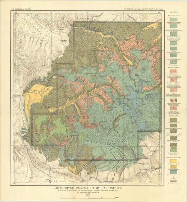
F. White River Plateau Timber Reserve Showing Distribution of Commercial Timber, Burned Areas, Etc., by George B. Sudworth, dated 1898 (14.2 x 16.1").
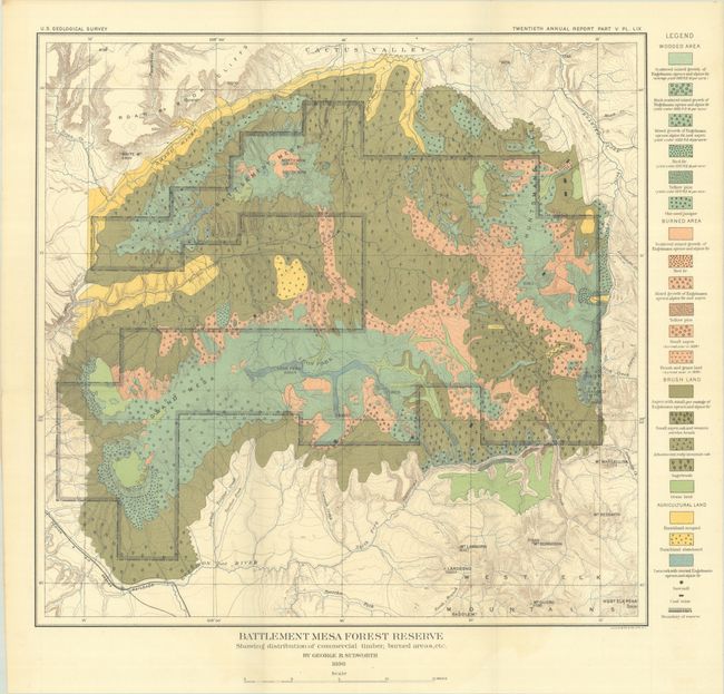
G. Battlement Mesa Forest Reserve Showing Distribution of Commercial Timber, Burned Areas, Etc., by George B. Sudworth, dated 1898 (16.2 x 15.7").
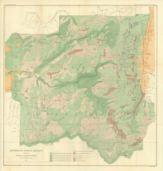
H. Bitterroot Forest Reserve Showing Land Classification, by J.B. Leiberg, dated 1898 (24.5 x 25.6").
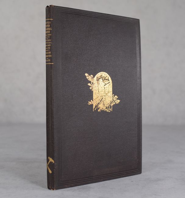
Housed in a brown cloth portfolio with gilt illustration on the front cover and gilt title on the spine.
References:
Condition: B+
The large folding map of Washington has some minor toning, a few spots of foxing, and some creasing in the top blank margin. The other maps are very good to mostly near fine with some occasional faint toning and color offsetting. Portfolio covers are near fine.