Subject: Western United States
Period: 1873 (published)
Publication: New Topographical Atlas of the State of Maryland
Color: Hand Color
Size:
25.1 x 16.5 inches
63.8 x 41.9 cm
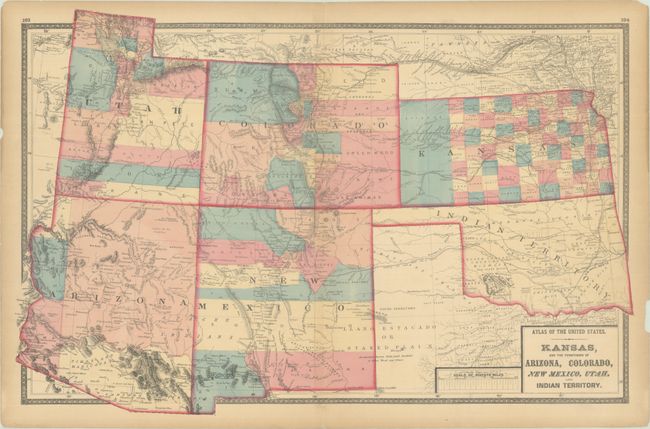
An uncommon, striking, double-page map of the American Southwest. Arizona depicts only 5 counties with a huge Yavapai County occupying the majority of the territory. In Colorado, the Gold Region along the Front Range is prominently depicted. Western Kansas is dominated by Shyenne County, and the Staked Plain is prominently shown in western Texas. The map is filled with roads, railroads, Indian tribes, as well as the U.S. Mail Route, Santa Fe Road, and Santa Fe and Fort Smith Road.
References:
Condition: B+
Contemporary color on a lightly toned sheet with a 1" tear across the upper centerfold and two 0.75" edge tears that have all been repaired with archival tape on verso. There are a few chips and small tears along the sheet edges, which have been backed with archival tape for support.