Subject: Kansas & Nebraska
Period: 1866 (dated)
Publication:
Color: Hand Color
Size:
33.1 x 23.6 inches
84.1 x 59.9 cm
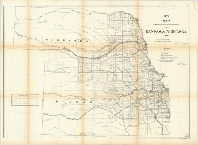
This detailed GLO map shows the whole of Kansas and Nebraska with counties delineated and surveying complete in the eastern portions. Lincoln and Dawson are the furthest west counties in Nebraska. Two railroad land grants stretch 40 miles wide as they head west, including the grant for the Union Pacific Railroad, which is shown completed to Morrows Ranche on the Platte River. Also of interest is the Butterfield's Overland Despatch Route shown west from Fort Ellsworth. Whitehairs Village, delineated with numerous tipis in southeastern Kansas, is the most prominent Native American village. The map further locates numerous towns, trust lands, reserves, military lands, and five different mineral types.
References: Wheat (TMW) #1151.
Condition: B
Issued folding with light toning along the fold lines. There are several tiny splits at the fold junctions with minor loss of image.